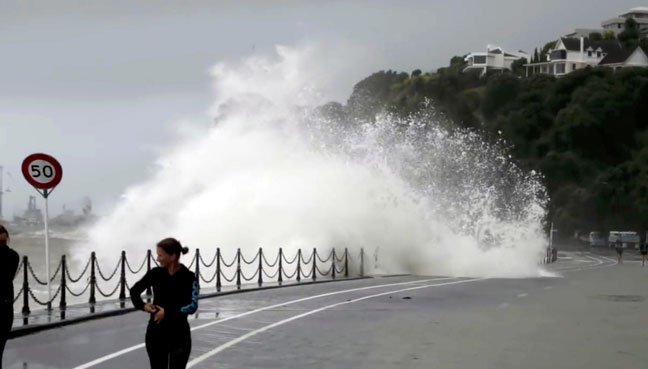
Cyclone Gita is pounding New Zealand with torrential rain, damaging winds and large waves.
MetService says the eye of the storm has hit landfall and is now hovering over the northwestern tip of the South Island.
Over the next few hours it’s expected to move south-east, settling over the South Island’s upper east coast tomorrow morning.
It forecasts more heavy rain overnight and into the morning for the Kaikoura Coast, Canterbury, and eastern Otago.
There will be gale force wind gusts for the upper South and lower North Islands, but these will ease tomorrow.
These winds will cause large waves bigger than six metres high, which threaten to inundate much of the coast from Raglan to Wellington in the North Island, and everywhere north of Buller in the South.
However, MetService says the very worst of the weather is likely over, and conditions are expected to ease as Gita moves away on Wednesday.
MetService forecast for tomorrow:
Nelson, Malborough and Buller
Rain and northwesterlies are forecast for Nelson tomorrow with heavy rain at times from midday onward. Malborough will experience some heavy showers and possible thunder in the afternoon. Strong northwesterlies about the sounds and gale southwesterlies about the Kaikoura coast. Buller will get rain with heavy and possibly thundery falls.
Christchurch
Rain, heavy at times, and strong southwesterlies, both easing from the afternoon.
Taranaki
Taranaki will be overcast with periods of rain in the north. Gale northwesterlies will ease in the morning.
Westland
Scattered rain which will clear from the afternoon.
Wellington and Wairarapa
Wellington will get early rain which will ease to a few showers then become widespread again in the early evening, possibly heavy and thundery. Strong northerlies. The Wairarapa is getting showers, some possibly heavy. Southerlies will die out in the evening.
Dunedin and Otago
After a downpour overnight, rain will clear in the morning give way to fine spells.


