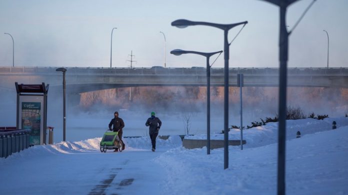
Canada logged its coldest temperature in years on Sunday as the remnants of a polar vortex set in across most of the country.
According to Environment Canada’s weather conditions report, Wekweeti in the Northwest Territories confirmed a -51.9 C reading, which the agency says is Canada’s coldest temperature in nearly four years.
Environment Canada meteorologist Terri Lang told CTVNews.ca on Monday that the last time a temperature that cold was recorded in Canada was in March 2017, when the mercury plunged to -54.7 C in Mould Bay, N.W.T.
Lang said the record-breaking cold has been brought on by the remnants of a polar vortex moving across western Canada, causing some regions to feel as cold as -60 with the wind chill.
“The spinning up of the cold air up around the North Pole… deepens and strengthens in the winter because of the lack of sunshine,” Lang said in a telephone interview.
Lang explained that polar vortexes are not unusual, and their remnants push into Canada most winters around this time.
She said a polar vortex contains Arctic air that sits over the poles for much of the winter. When those weather systems break down heading into spring, Lang said, that Arctic air then falls into Canada.
“Across [the] Prairies, we’re just getting some of that cold air that’s coming down because the jet stream has looped far enough south. This is what happens every winter, and it’s what gives Canada its cold weather,” Lang said.
Lang said the polar vortex is breaking cold records across the western provinces. She noted that the weather system has resulted in Uranium City, Sask. tying their all time cold record at -48.9 C while Fort Chipewyan, Alta. set a new record of -47.2 C.
With the Arctic air moving down into Western Canada, Lang said the vortex is pushing warmer air north. Environment Canada reported that some areas in eastern Nunavut experienced relatively mild temperatures on Sunday, with warm air pushing the reading up to 2 C.
Lang said the remnants of the polar vortex will remain situated between Alberta and Manitoba for the week, and also move into some regions of British Columbia as the wind chill adds to the cold.
“It’s going to be here for a while,” Land said. “Once that really deep, cold air settles in, it’s kind of hard to move out. It’s very dense, it’s very heavy, so it’s really hard to get it out of there.”
Lang said long-range forecasts are predicting that the cold weather will remain until next weekend. While it won’t feel like -60 every day, Lang said more cold temperature records can be expected across the Prairies in the meantime.
“It doesn’t mean every day is going to be really excessively cold but certainly, we’re going to see a lot of extreme cold readings for the next week because even if it warms up a little bit, sometimes the wind kicks in and your wind chills are still high,” Lang said.
While Western Canada deals with the remnants of a polar vortex, a major winter storm blasted Atlantic Canada overnight on Sunday, leaving parts of the Maritimes covered in snow. According to Environment Canada, that weather system is expected to push into Newfoundland and Labrador bringing whiteout conditions to certain regions.
In Ontario, the agency says cold temperatures and strong winds whipping across the Great Lakes have caused snow squalls to batter the southern region of the province, while parts of Quebec continue to dig out from last week’s winter storm.


